Vancouver's Transparency Gap in Urban Development Visualization
Residents of Vancouver deserve comprehensive access to three-dimensional models that clearly illustrate how proposed developments will transform their neighborhoods. Unlike Toronto and several other major Canadian cities, Vancouver fails to provide easily accessible data that enables citizens to create interactive 3D visualizations of upcoming towers, apartment complexes, and housing projects.
The Toronto Model: A Benchmark for Public Engagement
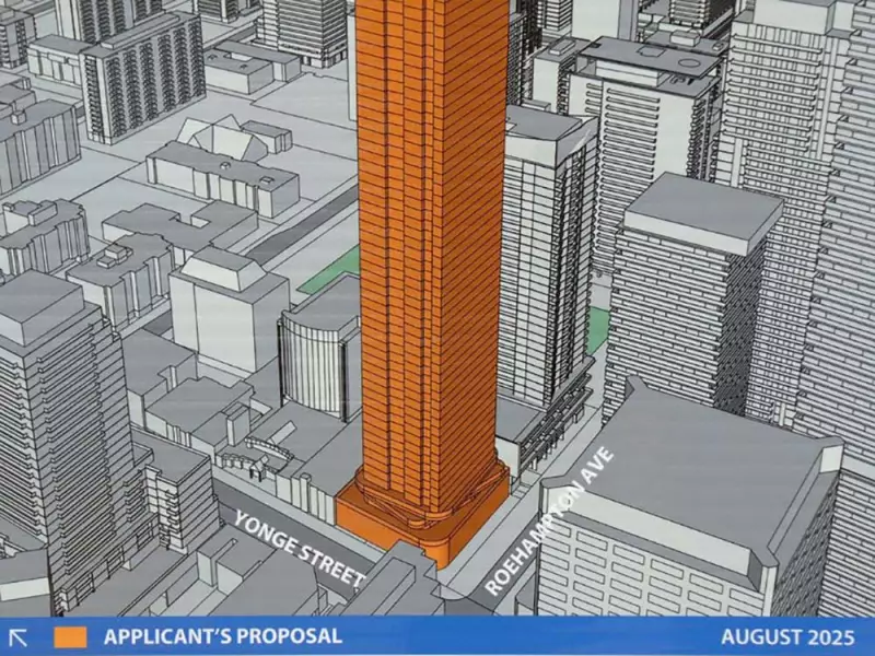
Toronto stands as a leading example of municipal transparency, offering citizens straightforward online access to development data that can be readily converted into functional 3D models. This approach empowers residents to visualize proposed buildings from multiple perspectives, understanding their scale, placement, and potential impact on existing urban landscapes.
Stephen Bohus, a visual effects designer with a background in landscape architecture, exemplifies the challenges Vancouverites face. He spends weeks manually constructing digital models from scattered data available on various City of Vancouver platforms. His work demonstrates what could be possible with better municipal data practices.

Beyond Toronto: A Growing National Trend
Toronto is not alone in prioritizing public access to development visualization tools. Cities including Montreal, Calgary, Kelowna, Nanaimo, and Victoria routinely provide citizens with data suitable for creating massing models—architectural representations that vividly convey a building's size, bulk, and neighborhood impact.
For decades, 3D imagery has been fundamental to property development professionals. These visualizations offer unparalleled insight into how new structures will integrate with their surroundings, casting shadows, altering sightlines, and changing neighborhood character.
The Power of Detailed Visualization
Bohus's models reveal critical details that two-dimensional plans cannot convey:
- How new towers will appear from aerial, ground-level, and interior viewpoints
- How proposed buildings will harmonize or conflict with existing architecture
- The precise shadow patterns cast by new developments on adjacent properties
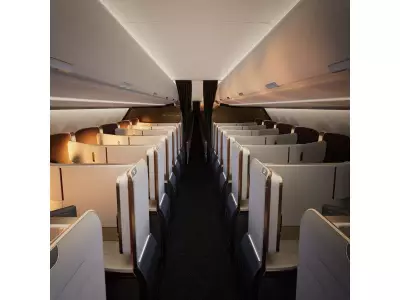
- Detailed interior perspectives, including specific views from future balconies
During a demonstration of his Broadway plan models, Bohus navigated inside a proposed condominium unit, showing exactly what residents would see of downtown Vancouver and the North Shore Mountains from their balcony—a level of detail currently unavailable through official city channels.
The Technical Divide: Manual Labor Versus Streamlined Access
Creating accurate Vancouver development models requires Bohus to manually extract measurements from two-dimensional plans available on city websites—a process taking days for each project. This contrasts sharply with Toronto's streamlined approach, where accessible data enables rapid model creation without specialized technical expertise.
This disparity raises important questions about democratic access to urban planning information. Should understanding neighborhood transformation require volunteer computer-graphics expertise, or should municipalities facilitate public comprehension through modern data-sharing practices?
As Canadian cities increasingly embrace digital transparency, Vancouver faces growing pressure to modernize its approach to development data accessibility, ensuring residents can visualize and understand the changes shaping their communities.