Dangerous Wind Chills to Grip Kitchener Region
A significant and potentially hazardous cold front is descending upon the Kitchener region, with forecasters predicting extreme wind chills overnight into Monday. The combination of plummeting temperatures and brisk winds is expected to create life-threatening conditions, prompting urgent warnings from meteorological authorities.
Impending Frostbite and Hypothermia Risks
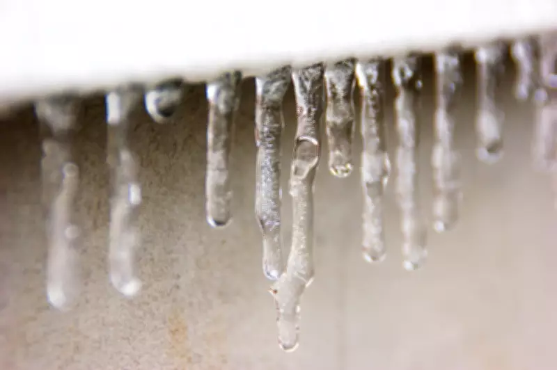
Environment Canada has issued a special weather statement highlighting the severe risk of frostbite and hypothermia. Exposed skin can freeze in a matter of minutes under such extreme wind chill values. Residents are strongly advised to limit outdoor exposure and ensure they are dressed in multiple layers, including insulated jackets, hats, gloves, and face protection.
Vulnerable populations, such as the elderly, young children, and those experiencing homelessness, are at particular risk. Local shelters and community centers are preparing for increased demand as the cold snap intensifies. It is crucial to check on neighbors and family members who may need assistance during this period of severe weather.

Precautions for Home and Vehicle Safety
Beyond personal safety, the extreme cold poses threats to infrastructure and vehicles. Homeowners should ensure their heating systems are functioning properly and take steps to prevent frozen pipes. For those who must travel, vehicle preparedness is essential:
- Keep gas tanks at least half full to avoid fuel line freeze.
- Carry an emergency kit with blankets, extra warm clothing, and non-perishable snacks.
- Ensure your vehicle's battery is in good condition, as cold weather can significantly reduce its power.
Public health officials emphasize that frostbite can occur even during brief periods outdoors. Symptoms include numbness, tingling, or pale, waxy skin. If these signs appear, it is vital to seek warmth immediately and avoid rubbing the affected areas, as this can cause tissue damage.
Broader Regional Weather Patterns
This cold warning is part of a larger pattern affecting Southern Ontario, with similar advisories in place for neighboring areas like Simcoe Muskoka. The sudden drop in temperatures follows a period of relatively mild winter weather, catching some residents off guard. Meteorologists attribute the shift to a strong Arctic air mass moving southward, which will dominate the region for at least the next 48 hours.
While the extreme wind chills are expected to peak overnight into Monday, conditions are forecast to gradually moderate by mid-week. However, residents should remain vigilant and stay updated on the latest weather alerts. Preparation and awareness are key to safely navigating this severe cold event in the Kitchener region.