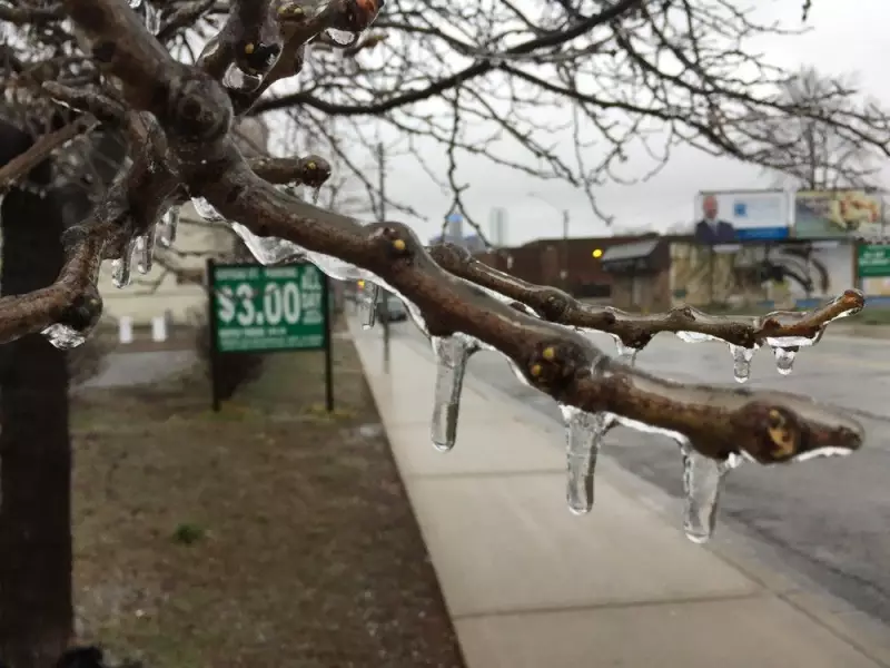
Residents of Windsor and Essex County are being urged to prepare for hazardous travel conditions as Environment Canada has issued a special weather statement warning of potential freezing rain.
Timing and Expected Accumulation
The national weather agency issued the alert Monday afternoon, forecasting several hours of freezing rain beginning on Tuesday morning. Officials warn that this could lead to an ice accumulation of one to two millimetres on surfaces.
The overnight low from Monday into Tuesday is expected to be -2 degrees Celsius, with a wind chill making it feel like -6. The precipitation is projected to start early Tuesday morning. While the freezing rain may mix at times with snow or ice pellets, it is expected to change over to regular rain as temperatures climb above freezing to a daytime high of 4 C.

Potential Hazards and Safety Advice
Roads and walkways are likely to become icy and slippery, creating dangerous conditions for drivers and pedestrians. Environment Canada specifically notes that these icy surfaces could be difficult to see, increasing the risk of slips and falls or vehicle accidents.
The weather statement also cautions that localized power outages are possible due to ice accumulation on trees and power lines. Residents are advised to be prepared for potential brief utility disruptions.
Looking Ahead at the Week's Forecast
Following Tuesday's icy start, temperatures are forecast to remain above freezing for the remainder of the week. The next significant chance of precipitation isn't expected until Friday, which is forecast to bring rain showers. There is also a possibility of snow flurries by Sunday, according to the current outlook.
For the latest information on road conditions and traveller advisories, the Ontario Ministry of Transportation provides updates online at ontario.ca/511 or via phone by dialing 511.