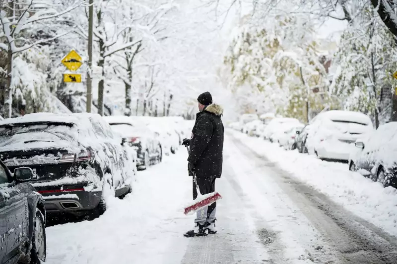
The Greater Montreal area is set for a return to classic winter conditions this weekend, with Environment Canada forecasting a substantial snowfall for Saturday, January 10, 2026. Current predictions indicate the region could receive up to 15 centimetres of accumulation, prompting advisories for residents to prepare for potentially difficult travel and the need for snow clearing.
Weather System Details and Timing
A low-pressure system is expected to move into southern Quebec from the United States, bringing precipitation that will start as rain or a wintry mix before transitioning to snow. The heaviest snowfall is anticipated throughout the day on Saturday. This follows a winter season that has already seen significant snow events, including a heavy fall documented in Montreal back in November 2025.
Meteorologists are tracking the system closely, noting that temperature gradients will be key in determining the exact precipitation type and final totals. Slight shifts in the storm's track could alter accumulation amounts for specific neighbourhoods within the metropolitan area.

Preparations and Potential Impacts
City crews are likely to be out in force, pre-treating major roadways and preparing snow-removal equipment. The forecasted snow could significantly impact weekend travel plans, including road conditions and visibility for drivers. Air travel at Montreal-Trudeau International Airport may also experience delays or cancellations, so passengers are encouraged to check their flight status.
Residents are advised to take standard winter precautions:
- Allow extra time for any necessary travel.
- Ensure vehicles are equipped with winter tires and have a snow brush and scraper.
- Consider postponing non-essential trips during the peak of the snowfall.
- Check on vulnerable neighbours who may need assistance with shovelling.
Context Within a Broader Weather Picture
This snow event for Montreal is part of an active weather pattern across Canada. While Quebec prepares for snow, other regions are facing their own distinct conditions. For instance, Ottawa can expect sun today before snow arrives tonight, and British Columbia's coast is under high streamflow advisories due to approaching atmospheric rivers bringing heavy precipitation.
The weekend snowfall serves as a reminder that winter is firmly in place across much of the country. After the storm passes, colder air is expected to follow, ensuring the snow will stick around, at least for the immediate future.