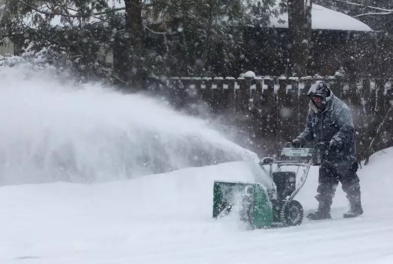
Residents and city crews in Ottawa are working to clear away the aftermath of winter's most significant snowfall this season, which blanketed the capital with heavy snow on Thursday. While school buses have resumed service within the city, the cleanup continues under the threat of more flurries forecast for the coming days.
Cleanup Efforts and Transportation Impacts
School buses returned to Ottawa's streets on Friday as the massive cleanup operation from Thursday's storm progressed. However, the situation remains disrupted in areas outside the city core, where bus services were cancelled for a second consecutive day. Officials are warning commuters that roads remain slippery, which could lead to delays.
Despite the transportation challenges, schools under the Catholic District School Board of Eastern Ontario and the Upper Canada District School Board remained open. The Student Transportation of Eastern Ontario agency confirmed buses were not running in its regions due to the persistent snow and unsafe road conditions.

Snowfall Totals and Ongoing Forecast
The storm deposited approximately 25 centimetres of snow on Ottawa starting Thursday morning. An additional two to four centimetres were expected to fall through Friday evening, adding to the existing piles. The city lifted its overnight parking ban at 7 a.m. on Friday to facilitate the cleanup.
Looking ahead, the weather pattern remains active. Flurries are expected to persist through the entire weekend, according to Environment Canada's forecasts. Residents should prepare for ongoing winter conditions as the city works to return to normal.
Chilly Temperatures and Detailed Weekend Outlook
Friday dawned with sunshine, but clouds were predicted to move in during the afternoon. The day's high was forecast to be a frigid -11°C, with wind chill making it feel like -27°C in the morning and -14°C later in the day.
The weekend forecast is as follows:
- Saturday: Cloudy with snow flurries in the afternoon and evening. The high is expected to be -1°C, though wind will make it feel colder.
- Sunday: A mix of sun and cloud with a 40 percent chance of flurries. The high should be around -4°C. Clouds increase Sunday night, bringing a 60 percent chance of flurries and a low of -12°C.
Friday evening may see the onset of more snow, accompanied by brisk winds up to 15 km/h creating a wind chill effect of -19°C. The City of Ottawa and its residents are bracing for a continued battle with winter's grip as they navigate the snowy streets and sidewalks.