Southern Ontario is set to be hammered by another significant winter storm, with Environment Canada issuing urgent weather alerts for heavy snowfall and potential blizzard conditions starting Sunday evening.
Orange Alerts Target Regions East of Lake Huron
Communities east of Lake Huron are expected to face the brunt of this major winter system. Environment Canada has issued orange alerts for areas stretching from Stratford, Mitchell, and Southern Perth County northward to the Bruce Peninsula, including Sauble Beach and Tobermory.
The national weather service warns that intense lake-effect snow squalls could dump between 20 to 40 centimetres of snow, with even higher amounts possible in some localities. The most intense snowfall is forecast for Monday night into Tuesday.

Blizzard Conditions and Power Outage Risks
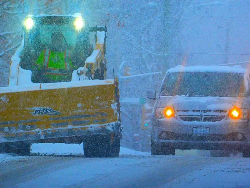
The situation is expected to deteriorate significantly on Monday. Possible blizzard conditions are forecast for late Monday afternoon through the evening, driven by westerly winds gusting up to 90 kilometres per hour.
These powerful winds, combined with heavy snow, will create dangerously reduced visibility. Environment Canada explicitly warns of hazardous travel conditions and the potential for power outages as the storm rages.
While winds may diminish somewhat Monday evening, the lake-effect snow is projected to continue into Tuesday and possibly Wednesday, prolonging the hazardous conditions.
Widespread Alerts Across the Province
The severe weather threat extends beyond the Lake Huron shoreline. A separate orange alert is in effect for the Picton and Sandbanks Park area, warning of similar snow squalls beginning Sunday night and comparable accumulations of 20 to 40 cm.
Environment Canada has also issued yellow alerts for other regions. The Georgian Bay area can expect around 10 cm of snow. In the Niagara region, snow squalls off Lake Erie are forecast to intensify overnight Sunday, bringing an estimated 15 to 25 cm of snow. Southwest winds gusting to 90 km/h near Lake Erie on Monday will create near-zero visibility in heavy snow and blowing snow, with additional power outage risks.
Residents in Belleville, Quinte West, and Eastern Northumberland County should prepare for 10 to 20 cm of snow, beginning as early as overnight Sunday.
Frigid Air Grips the GTA
While the Greater Toronto and Hamilton Area may be spared the heaviest snowfall this time, it will not escape the cold. A frigid Arctic air mass is pushing through the region this week.
In response to the dangerous cold, the City of Toronto has opened its warming centres to provide critical shelter for vulnerable residents in need of a safe, warm place.
Officials urge all Ontarians in affected areas to monitor updated forecasts, avoid non-essential travel once conditions worsen, and prepare for potential disruptions.