Toronto Faces Bitter Cold Start to the Week with Wind Chills Hitting -30°C
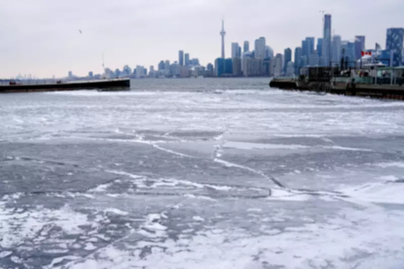
An intense arctic air mass has descended upon the Greater Toronto Area, bringing dangerously cold conditions to start the week. On Monday morning, residents woke up to wind chill values making it feel as cold as -30 degrees Celsius, prompting widespread advisories and warnings from meteorological authorities.
Current Weather Conditions and Immediate Impacts
The sudden temperature drop has created hazardous conditions across the region. Exposed skin can develop frostbite in just minutes under these extreme wind chill values, according to Environment Canada. Public health officials have urged vulnerable populations, including seniors and those experiencing homelessness, to seek shelter and limit outdoor exposure.
Transportation services have been affected, with transit agencies reporting increased delays on some routes. School boards across the GTA have implemented cold weather protocols, keeping students indoors during recess and lunch periods to prevent cold-related injuries.

Forecast: Relief on the Horizon
Despite the frigid start to the week, meteorologists are predicting a significant warming trend. A shift in weather patterns is expected to bring milder Pacific air into the region, with temperatures forecast to rise above freezing by mid-week. This transition should provide welcome relief from the extreme cold that has gripped southern Ontario.
The anticipated weather change aligns with broader climate patterns observed in recent years, where extreme temperature fluctuations have become more common during transitional seasons. Climate scientists note that while individual cold snaps don't contradict global warming trends, the increasing volatility of weather systems represents a significant climate change impact.
Historical Context and Climate Considerations
This cold event comes during what has been an unusually variable winter season for the Toronto region. The city has experienced both record warm periods and sudden deep freezes, creating challenges for infrastructure and public health planning.
Urban heat island effects, where built environments retain heat, typically moderate extreme cold in dense metropolitan areas like Toronto. However, when powerful arctic air masses penetrate southern regions, even urban centers experience significant temperature drops that test municipal preparedness and response systems.
Safety Recommendations and Preparedness
As the region navigates these extreme conditions, authorities recommend:
- Limiting outdoor exposure, especially during early morning hours when temperatures are coldest
- Dressing in multiple layers with wind-resistant outerwear
- Checking on vulnerable neighbors and community members
- Being aware of frostbite symptoms including numbness, tingling, and skin discoloration
- Preparing vehicles for cold weather operation with proper antifreeze and emergency supplies
While the immediate forecast promises relief from the deep freeze, meteorologists caution that late winter and early spring often bring unpredictable weather patterns to the Great Lakes region. Residents are advised to stay informed through official weather channels as conditions continue to evolve throughout the week.