Winter Storm Warning Issued for Sea to Sky Highway from Squamish to Whistler
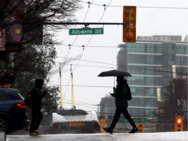
Environment Canada has issued a winter storm warning for the Sea to Sky Highway, stretching from Squamish to Whistler, as heavy rainfall threatens to cause significant disruptions. The warning, announced on Tuesday afternoon, highlights the potential for dangerous travel conditions due to extensive water pooling and possible washouts along this critical route.
Heavy Rainfall and Flooding Risks
On Tuesday at 6:40 p.m., the weather agency reported that up to 80mm of rain is expected to fall on the highway before easing off on Thursday morning. Another heavy rain event is forecast from Thursday night into Friday, compounding the risks. The combination of heavy rain and mountain snow could overload local river systems, leading to flooding in valleys and low-lying areas.
The freezing level is projected to be around 2,200 metres, which may contribute to snowmelt from higher elevations, exacerbating flood impacts. Environment Canada advises residents and travelers to prepare for quickly changing and deteriorating conditions, emphasizing the need for extra travel time and caution on the roads.

Travel Advisories and Safety Measures
"Prepare for quickly changing and deteriorating travel conditions. Allow extra time for travel. If driving, turn on your lights, slow down and maintain a safe following distance. Don’t drive through flooded roadways," the agency stated in its report. Drivers are urged to monitor conditions closely and avoid unnecessary trips during the storm.
In addition to the Sea to Sky Highway, a rainfall warning is in effect for the Fraser Valley, with up to 100mm of rain forecast from Tuesday night until midday Thursday. The east coast of Vancouver Island is also under an orange rainfall warning, indicating localized flooding is expected.
Broader Weather Impacts Across British Columbia
The atmospheric river responsible for these conditions is expected to persist over the South Coast of B.C. through Friday, bringing periods of heavy rain. Environment Canada's weather warnings are color-coded, with red being the most severe, followed by orange and yellow. In this case, the orange warning signifies significant risks.
A special weather statement remains in effect for sections of the Kootenay and Columbia regions, including Rogers Pass and Kootenay Lake, where snowmelt due to rain could lead to localized flooding. The atmospheric river is anticipated to pass by this weekend, offering some relief.
Ski Resort Forecasts and Local Conditions
Whistler-Blackcomb's alpine forecast for Wednesday predicts rain, with heavy snowfall expected starting on Friday and continuing through Monday as temperatures cool. Meanwhile, Vancouver's three local ski hills are currently experiencing rain, affecting winter sports activities.
To stay updated on driving conditions, travelers are encouraged to visit Drivebc.ca. This winter storm warning underscores the importance of heeding weather advisories and taking proactive safety measures during severe weather events in British Columbia.