Interlake Community Mobilizes as Flood Threatens Manitoba Region
Residents across Manitoba's Interlake region are actively preparing for potential flooding as water levels continue to rise with the spring thaw. The community, situated between Lake Winnipeg and Lake Manitoba, is no stranger to seasonal flooding, but this year's conditions have prompted heightened vigilance and early action from both homeowners and local authorities.
Historical Context and Current Concerns
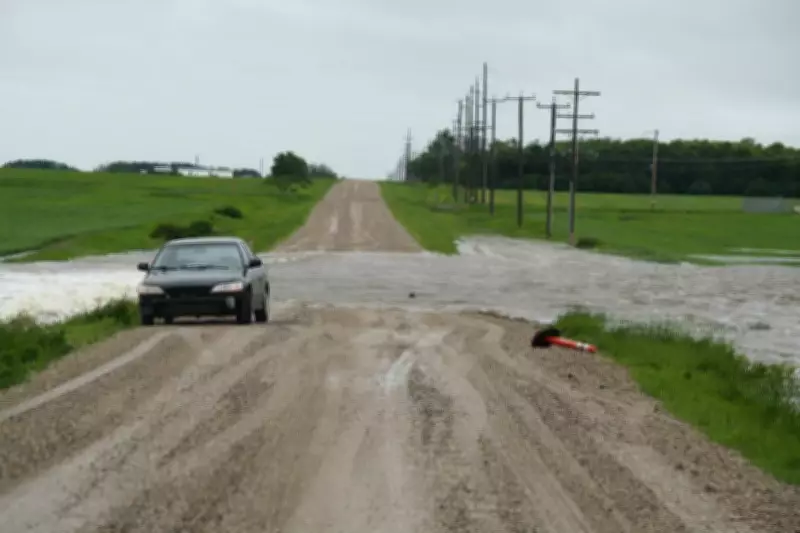
The Interlake area has experienced significant flooding events in the past, most notably during the devastating floods of 2011 and 2014. Historical data shows that when water levels rise in the region, roads can become impassable, agricultural land suffers damage, and homes face inundation. Current monitoring indicates that water levels are approaching concerning thresholds, with precipitation patterns and snowmelt contributing to the increased risk.
Local officials have been coordinating with provincial emergency services to ensure adequate resources are available if evacuation becomes necessary. Sandbagging operations have already begun in vulnerable areas, with volunteers working alongside municipal crews to protect critical infrastructure and residential properties.

Community Response and Preparedness Measures
Homeowners in low-lying areas are taking preventive actions, including moving valuables to higher ground, checking sump pumps, and securing emergency supplies. Many residents have shared that their experiences from previous floods have informed their current preparations, with some having already installed permanent flood mitigation measures around their properties.
"We learned hard lessons from past floods," said one longtime Interlake resident. "Now we start preparing as soon as the snow begins to melt, rather than waiting until water is at our doorstep."
The provincial government has activated its flood forecasting system, providing regular updates to municipalities and residents. Emergency response teams are on standby, with equipment positioned strategically throughout the region to respond quickly if conditions deteriorate.
Environmental Factors and Climate Considerations
Climate scientists note that changing weather patterns may be contributing to more frequent and severe flooding events in the region. Warmer temperatures leading to accelerated snowmelt, combined with increased precipitation, create challenging conditions for flood management. The flat topography of the Interlake area exacerbates these challenges, as water spreads widely across the landscape rather than following defined channels.
Agricultural producers are particularly concerned, as flooding can damage crops, equipment, and infrastructure. The timing of this year's potential flood coincides with the beginning of planting season, adding economic pressure to an already stressful situation for farmers.
Looking Forward and Ongoing Monitoring
Authorities emphasize that while preparations are underway, the situation remains fluid. Water levels will continue to be monitored closely in the coming days and weeks, with adjustments to response plans made as conditions evolve. Residents are encouraged to stay informed through official channels and to report any concerning developments to local emergency services.
The community's resilience is being tested once again, but the collective experience from previous flooding events has created a culture of preparedness that may help mitigate the worst impacts of this year's rising waters.