Residents of Metro Vancouver dreaming of a white Christmas are likely to see rain instead, but significant snowfall is expected to create hazardous driving conditions on several key British Columbia highways over the holiday period.
Warnings in Effect for Major Routes
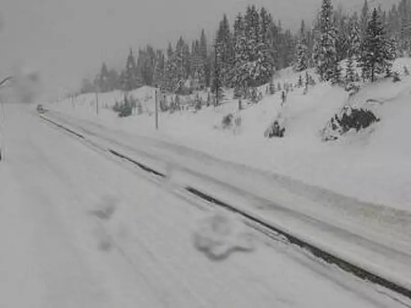
On Christmas Eve, Environment and Climate Change Canada posted multiple snowfall warnings for critical transportation corridors. The alerts cover the Sea to Sky Highway from Brandywine to Whistler and sections of the Coquihalla Highway from Hope to Merritt and from Merritt to Kamloops.
The federal weather agency forecasts that a frontal system moving from Washington state will bring heavy snow to southwestern B.C. The snow began on Wednesday morning and was expected to intensify throughout the day.

Expected Snowfall Amounts and Travel Impacts
Accumulations could be substantial, with up to 25 centimetres of snow predicted for the Sea to Sky Highway by Wednesday evening. Along the Coquihalla, drivers should prepare for 10 to 15 centimetres between Hope and Kamloops, while the Fraser Canyon may see up to 10 centimetres.
Travel is expected to be challenging due to rapidly accumulating snow and potentially reduced visibility. Drivers are urged to exercise extreme caution. The Coquihalla Highway, which was closed on Tuesday following several crashes, has since reopened, but conditions remain volatile.
Metro Vancouver's Holiday Forecast
While the highways brace for snow, the Metro Vancouver region is set for a wetter holiday. Overnight on Christmas Eve, significant snow in the city is unlikely, though higher elevation areas could see some flakes overnight on Christmas and into Boxing Day morning.
The forecast for Christmas Day in Vancouver calls for a 60 per cent chance of showers with a low of 1 C, followed by rain and a high of 7 C. Thursday night brings a chance of rain or snow with a low of 2 C. Boxing Day is expected to see rain or snow with a high of 4 C.
Looking ahead to the weekend, Metro Vancouver can expect a mix of sun and cloud on Saturday with highs of 4 C, before showers return on Sunday along with possible snow flurries overnight.