Residents across parts of New Brunswick are bracing for a messy mix of winter precipitation as a new weather system moves into the region. Environment Canada has issued forecasts warning of snow, freezing rain, and rain for Tuesday, January 6, 2026, creating potentially hazardous travel conditions.
Forecast Details and Expected Impacts
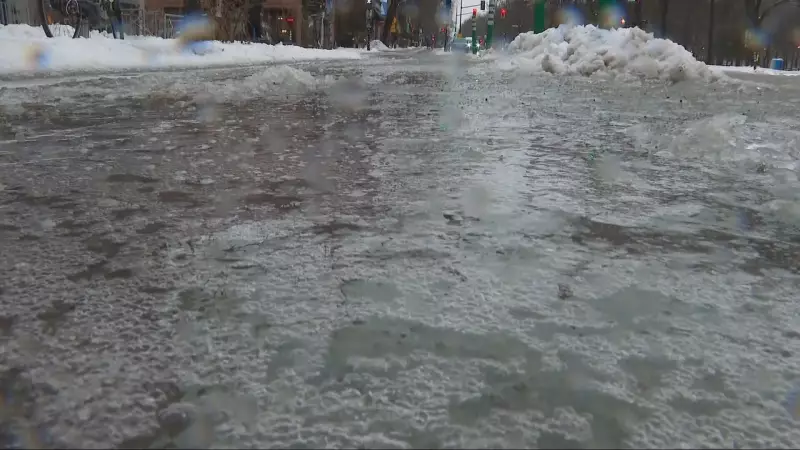
The national weather agency indicates that several areas within the province could see a combination of precipitation types throughout the day. The event is expected to begin with snow, which may transition through a period of freezing rain before eventually changing over to rain in some locales. This classic winter storm progression poses a significant risk for ice accretion on roads, sidewalks, and power lines.
The timing of the freezing rain is particularly critical for the morning commute on Tuesday. Similar to an event that coated streets in ice just over a week prior on December 29, 2025, this new system threatens to create slick, dangerous surfaces. Drivers and pedestrians are urged to exercise extreme caution, allow extra travel time, and consider postponing non-essential trips until conditions improve.

Preparedness and Safety Advice
With freezing rain in the forecast, preparation is key. Environment Canada and local authorities typically advise the public to take several precautions. These include ensuring vehicles are equipped with winter tires and a full windshield washer reservoir, dressing in layers to protect against the cold and wet conditions, and having an emergency kit at home in case of power outages.
Icy conditions can lead to sudden slips and falls, power disruptions, and difficult driving. Residents should monitor updated forecasts and any weather warnings or statements from Environment Canada, as the exact track and intensity of the system can shift. Municipal crews are likely on standby to apply salt and sand to major roadways, but secondary streets and walkways may remain treacherous.
Context and Regional Weather Patterns
This forecast for New Brunswick is part of an active winter weather pattern affecting Eastern Canada. The province is no stranger to mixed precipitation events, especially in early January when temperatures often hover around the freezing mark. The potential for freezing rain—when liquid precipitation falls onto surfaces at or below zero degrees Celsius—is a recurring and dangerous winter hazard in the Maritimes.
As the day progresses on January 6, temperatures in some affected areas are predicted to rise slightly, which would allow the freezing rain to change over to plain rain. However, the damage and travel disruption from the initial icy phase will likely have already occurred. Staying informed through official channels is the best defense against the unpredictable nature of these winter storms.